blah blah blah
Dryad Fall
Length: 3.2 miles out-and-backDifficulty (click for info): Easy
Elevation Gain: 650 feet
Rating (click for info): 6/10
Height: 300'
River: Dryad Brook
Driving Directions:
Trailhead and parking area are at the end of Mill Brook Road (a rough dirt road) in Shelburne, NH (Dryad Fall is in Success). To get there, take Meadow Road off Rt. 2, 4.9 miles east of Rt. 16. Drive 0.9 miles to the end of Meadow Road at North Road. Turn left, then immediately right onto Mill Brook Road. Drive down it for 1.5 miles and bear left, where the road immediately ends at a stream. Park just before, in the open area. NOTE: Mill Brook Road is reported to have been gated in the past. If there is a closed gate, use the alternative trailhead further west on North Road.
About the Hike:
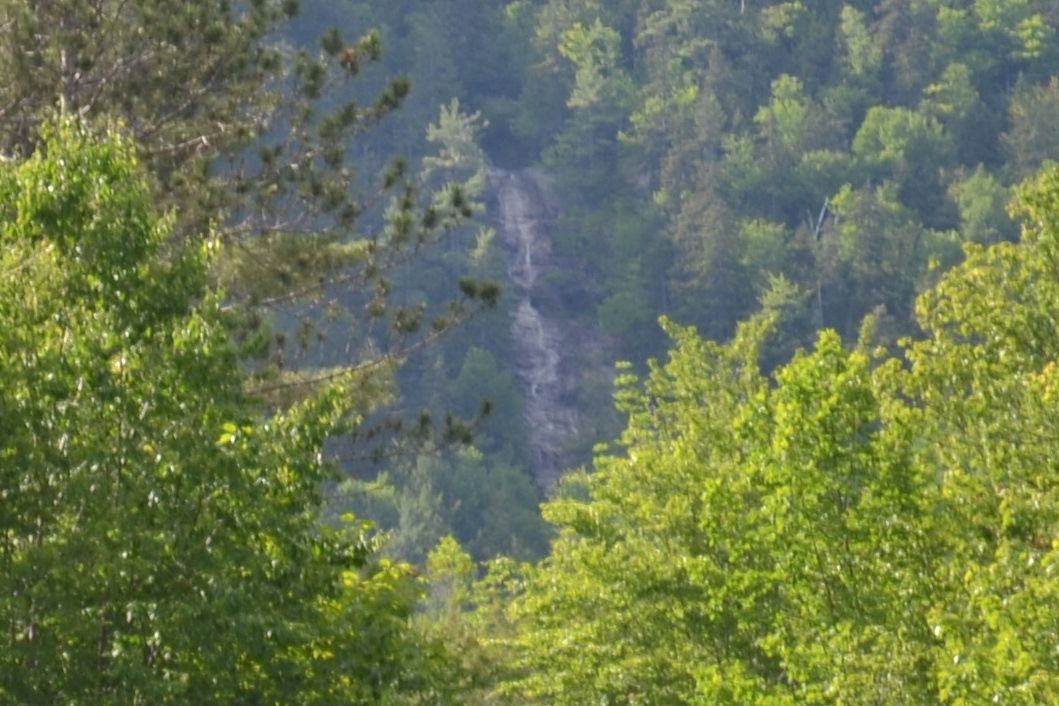
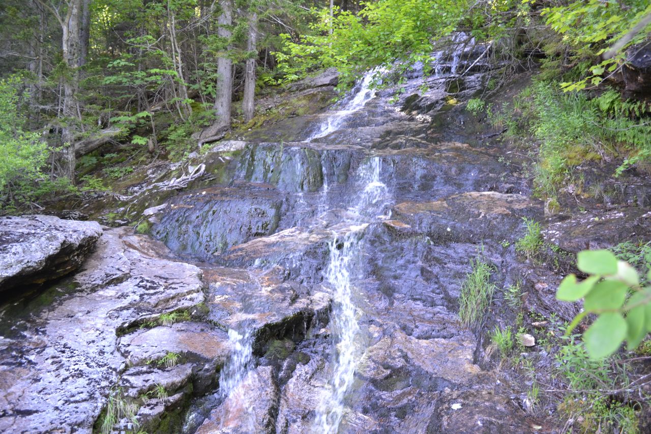
Officially, New Hampshire's tallest waterfall is Arethusa Falls. Unofficially, Dryad Falls is the tallest, by a wide margin. Unfortunately, the amazing height of this hidden beauty cannot be seen up close, at least not from any trail. This doesn't mean, however, that you cannot still see Dryad Fall. The Dryad Fall Trail will take you to a flat spot in the middle of the waterfall (near the top), where you can enjoy about 55 feet of it. You can get to this trail from the Austin Brook Trail, which begins on North Road. This route is very long, and the reward is not quite worth the effort. However, by driving about a mile and a half down a rough dirt road, you can shorten the hike to about three miles round-trip. There was a time when you could hike there and back in 1.6 miles, but since then, a bridge has been removed, and you must follow the trail down the dirt road to the original trailhead.
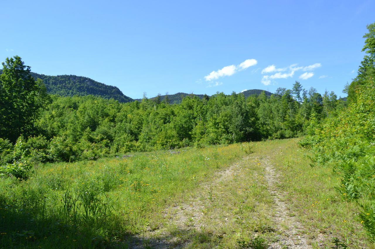
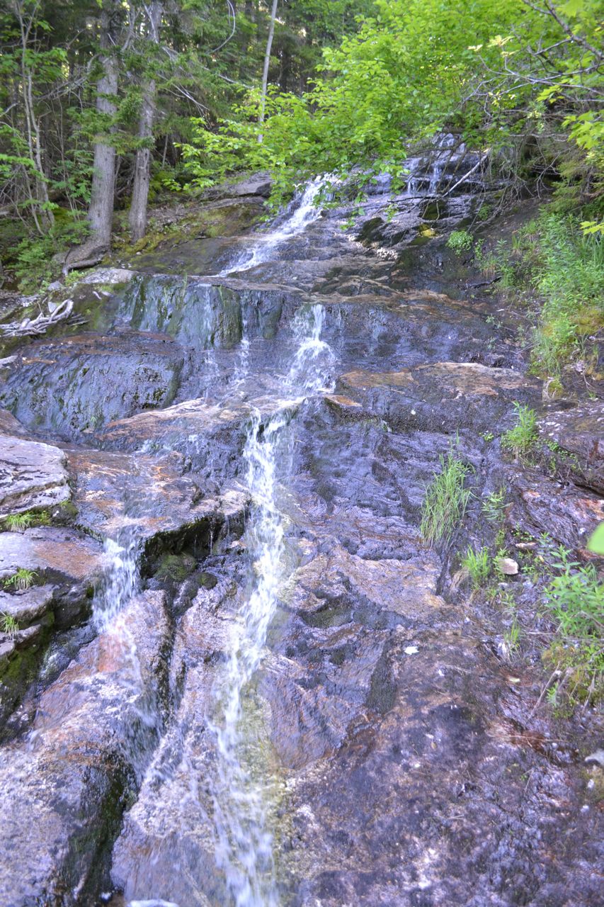
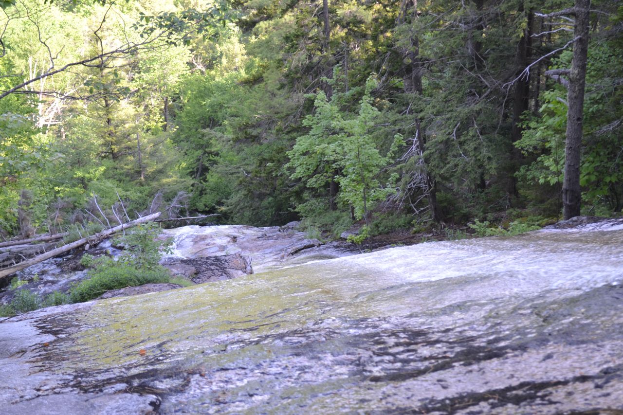
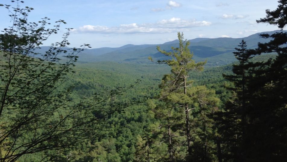
From the parking area, cross the stream and turn right (Gates Brook Trail bears left), following Mill Brook Road/Austin Brook Trail on foot for 0.8 miles until you reach the original parking area. In a clearing on this road walk, you can look up to a ravine in between two mountains and actually see the entire waterfall from a distance. When you reach the original trailhead, cross another stream and continue down the old road, soon bearing left into the woods at a sign. The trail climbs uphill at a moderate grade. After 0.4 miles in the woods, turn left onto Dryad Fall Trail. This trail continues climbing 0.4 miles to the spur to Dryad Fall, on the left. The spur emerges near the top of the falls, at a pool. From here, you can see about 15 feet of the waterfall above you and about 40 feet below. The waterfall is very pretty, but can be a little seasonal. The part above is an stepping cascade, and the portion below is a picturesque water slide. We imagine the 250 feet below that is just as nice, but for now, you can only see that from the dirt road. In addition to the waterfall, there is also a fine mountain view.
Printable directions page